Open-source Map3D builds city 3D models from OSM data and exports GLB
A Map3D-family open-source tool trending on X. What it claims — building 3D maps with buildings and roads from OpenStreetMap data and exporting GLB for Blender,
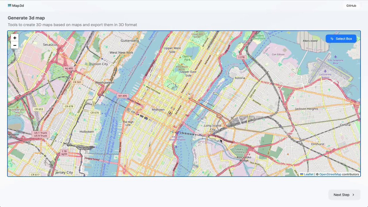
X user @liambraus (liam.) posted on October 7, 2026 about a GitHub repository that takes a city name, builds a 3D city model with buildings and streets from OpenStreetMap (OSM) data, and exports a GLB file. In a follow-up post the author named the repository directly: https://github.com/cartesiancs/map3d. The thread drew developer reactions, including urban-planning projects and neighborhood tests.
Image source: @liambraus on X
The original post, written in Spanish, describes the tool as MIT-licensed with no login and no API key required. That licensing and usage claim is the author's own description. This verification pass could not retrieve the canonical repository's (cartesiancs/map3d) README directly, so the MIT label is cross-confirmed only through the search index of a Map3D-family repository marked as a fork (Oli97430/map3d). Check the canonical repository's license file yourself before use.
What the tool does
According to the search-index description of the Map3D-family repository, the tool generates 3D maps from real OSM data and exports them as GLB files for Blender, Three.js, Unity, or other 3D engines.
- It uses building height from OSM tags, or estimates height from floor levels when height is missing.
- It generates a city 3D map with building and road information.
- It exports the finished scene as GLB for use in external 3D tools.
The same index lists React 19, Three.js, and Vite as the stack and https://map.fleet.im as the homepage. These details also come from the fork's index, so they may differ from the canonical repository (cartesiancs/map3d).
Who it is useful for
- Developers who need real city geometry for Three.js, Blender, or Unity prototyping
- Practitioners who need quick urban-planning or architecture visualization mockups
- Anyone wanting to pipe OSM data into a 3D asset workflow
The author framed it as doing for free what paid render work does. That is the author's own assessment; actual quality depends on OSM mapping coverage described below.
Check before using
The most important limitation, raised in thread replies, is OSM data coverage. Areas with sparse building height or floor-count tags can come out flat. One reply noted many buildings in Latin American cities lack height and level data, and the original author agreed with the advice to compare at least one block against reality before presenting it. Conversely, well-mapped downtown areas reportedly produce accurate heights from level tags.
Pre-use checklist:
- Check the OSM building height and level-tag coverage of your target city first
- Compare one block against reality to verify height-estimation quality
- Open the canonical repository (cartesiancs/map3d) README and license yourself to confirm the MIT status and usage
- Keep in mind the fork (Oli97430/map3d) and the canonical repository may differ in features and deployment URL
Sources
- @liambraus original post: repo turning a city into a 3D model
- @liambraus follow-up post: repo: cartesiancs/map3d
- Map3D-family fork repository index: Oli97430/map3d
- Canonical repository (README not retrieved, verify directly): cartesiancs/map3d